
About this site
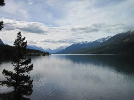
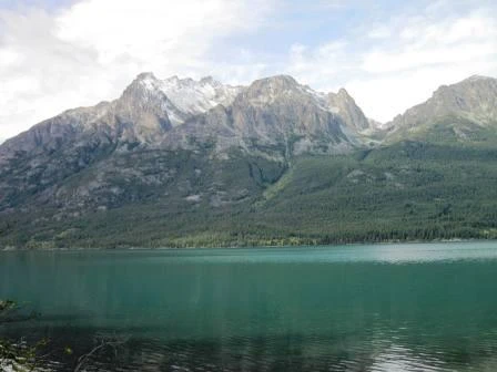
Source ↗This picturesque camping spot is set amongst mature Douglas-fir trees overlooking the turquoise waters of Tatlayoko Lake, and offers impressive views of Niut Mountain. There is a small boat launch at the recreation site. Tatlayoko Lake can be prone to strong winds. INDIGENOUS TERRITORY: Tatlayoko Lake is situated within the declared aboriginal title lands of the Tsilhqot'in (pronounced "sil-ko-teen") Nation and caretaker area of the Xeni Gwet'in First Nation. The name "Tatlayoko" is likely an anglicization of the Tsilhqot'in name for this area, which is "Telhiqox." Telhiqox Biny is the Tsil…
Boat launchFishingLakePit toilet
Where it is
51.6374, -124.3898Loading map…
Rec Site
Weather forecast
next 14 daysThu24°12°0%
Fri20°10°2%
Sat15°9°24%
Sun12°5°65%
Mon12°3°22%
Tue11°5°60%
Wed18°3°6%
Thu19°5°10%
Fri19°8°10%
Sat17°7°31%
Sun15°7°23%
Mon17°2°14%
Tue13°9°20%
Wed17°8°16%
Fire & air quality
No active fires within 100 km
Fire ban in effect · Cariboo
Air quality · Moderate (AQI 69)
Worst PM2.5 15.3 μg/m³, check local advisories
Drive from Kelowna, BC
drive (one-way)
692 km
drive time
10h 25m
round-trip
$274
166.0 L
Routed on real roads. Fuel at your current gas price.
Around this site
Fuel 33 km· West Chilcotin Trading LTDTown 6 km· Tatlayoko LakeLake 6 km· Lincoln LakeHot spring 123 km· Job Creek Warm SpringsTrailhead 151 km· Semaphore lakes trailhead
Photos
Your visit notes (0)
Find similar by activity →abettercamper.com